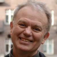
About Karttur
Karttur is a private research and development company in Stockholm, Sweden. The company is owned and run by me, Thomas Gumbricht. The main focus is on modelling Earth system processes using a combination of spatial data and Artificial Intelligence (AI). Through its subsidiary, xSpectre, co-owned with some friends, Karttur is also involved in development of state-of-the-art sensing hardware.
Notable achievements
- Karttur developed the first global pan-tropical wetland/peatland map.
- Extensive research related to the Okavango inland Delta, Botswana.
- Karttur operates an open source in-house developed spatial data cube - the GeoImagine Framework.
- Karttur has developed an open source modelling tool applying Machine Learning for predicting soil properties.
Resumes and resources
| Resource | Description |
|---|---|
| Professional portfolio | Thomas Gumbricht professional portfolio |
| GeoImagine data cube | Karttur’s in-house Open Source data cube for spatial data processing. |
| Soil spectral modelling | Open source Machine Learning package with instructions. |
| Watershed modeling | Open source package for watershed delineation and hydrological characterization. |
The GitHub pages of Karttur are created and maintained by Thomas Gumbricht.
